Saturday, November 30, 2019

Volcan Villarrica


  After spending a few days staring at the Villarrica volcano, I (Matt) decided it was time to climb it. The volcano is technically open for anyone to climb, but most people do it with a tour which includes all the necessary equipment. The tour begins with a 6AM meet-up in central Pucon, so right from the start it was rough. You pack a backpack with food, water, and gear, and head out to the volcano about an hour away. In the winter a full ski resort operates on the volcano, so from the foot you can choose to take a ski lift up and save yourself about an hour of climbing. I chose to take the ski lift and it is 100% worth it. Even with the lift, it was still 5 hours of continuous uphill climbing.


The view from the bottom of the ski lift- hardly a view at all!

  Once off the lift, everyone put on crampons and started trekking in a zigzag pattern up the first big incline. Like Hamilton, I thought, we faced an endless uphill climb. With the crampons on, walking on the packed, crisp snow was easy! I though to myself, I could do this all day. Well, I basically did do it all day and I was pretty tired by the end. Every hour or so I looked around and thought to myself, we must be nearly there. We weren't.


Trying the crampons on just after the ski lift. Total walking time so far: about 20 minutes

  The view got progressively better and better. I took a photo after getting off the ski lift and when I looked at it later it was laughable that I had thought that it was a good view. As we climbed, another volcano appeared on the horizon. As we climbed further, another volcano appeared beyond that one. Eventually I realized I could look to the east and see the Andes, and to the west I could see the Pacific Ocean- the entire width of Chile. 


Our first rest stop. Total walking time: probably an hour. It felt like we were nearly there (we weren't).

From here you could see the entire Villarrica Lake

In the distance 2 other volcanoes began to appear

  As we got higher, the wind grew stronger, and wind-shaped ice shapes began to cover the face of the volcano, like small horizontal icicles. We had been given ice picks and taught to use them to arrest our fall. At the bottom, it seemed unlikely they would be necessary. But as we climbed the small ice sheets became more and more ubiquitous until the entire face of the volcano was an ice sheet, and I began to think I really could slide down the mountain if I fell the wrong way. The little icicles became big icicles.


As it got windier and colder, I stopped pausing to take photos. Here's the view from the second rest stop. Total walk time: a drop in the bucket.


Distances are hard to judge on the featureless snowy volcano.

  Finally the black rocky top of the volcano came into view. We left out packs and made the final climb to the top. The rim is about 30 feet wide before it plunges down into the interior. On some days you can see magma at the bottom of the crater, but there was too much smoke to see it that day. It billowed out and blew away to the east. In a moment, the wind shifted and blew the smoke to the west, and everyone ran over to the previously smoky edge to peer inside (more volcanic rock). I asked if it was time to put on out gas masks to block the toxic fumes, and my guide said no. Then the wind snapped back and blew the gas cloud right over us. "Masks now!" yelled the guide. Even with the mask on, I was in a hurry to get out of the gas cloud, which smelled and made me cough.


The last stretch was still probably 30-40 minutes of climbing, but it was nice when the change from white snow to black rock made it feel like we were making progress.
The open volcanic crater

Distances in these photos can be misleading. This kind of shows how big the top of the crater was.

A glimpse into the crater. This is the top of the inner wall. To the right I could only see smoke.

  We hiked back down to our packs and took out small plastic boards which we used to sled down the volcano in paths worn down into the 3-foot-deep snow. What took us 5 hours to climb took about 30 minutes to sled down. My group was the last one off the mountain, and I was the last in line. I paused periodically to let the rest get ahead of me so I could build up some speed, and in those moments I was practically alone on the side of the volcano, looking out at a lake and two more volcanoes, in probably the best sledding experience I'll ever know. 


  The two other people in my tour were a Brazilian couple who arrived the day before and were leaving the day after. They came to Chile just to climb this volcano, and, amazingly, had never seen snow before. What an introduction to snow! They told me it was like "walking in soap".


  Meanwhile, Karen was having a very different kind of day...


Termas around Pucón

When I (Karen) lived near Temuco in 2011, everyone always mentioned it was fun to go visit the "termas" or hot springs a couple of hours away.  I never actually made it because of the distance and price (they cost up to $50USD/day!).  However, upon setting foot in Pucón it was clear I had a second chance to visit the famed hot springs.  After stopping by the town visitor center, we got a map of the surrounding area: it was COVERED in this icon.

There are about 20 different resorts all featuring hot springs.  The city map lists the temperature ranges of each location's springs, along with phone numbers and hours (if known) to allow for some easy comparison shopping.  I had no idea there were so many options, but I guess it makes sense- since the area has a lot of active volcanoes and lakes I guess it makes sense that some of the lakes are warm.  With so much competition, the hot springs really try to differentiate themselves.  Some make deals with tour companies to bus people in from town.  Others brand themselves as high-end with luxury facilities, dining, lodging etc.  

I opted for Pozones, one of the most economical options ($10 USD) and accessible by bus ($6USD round trip).  It was recommended by our Airbnb hosts.  I never particularly feel the need to visit hot springs, but given how beat I was from the hike at Huerquehue the previous day, it seemed like a good option, and it was!  My one complaint is that you have to walk a good 15-minutes down a steep-ish gravel path to get to the actual hot springs.  My aching knees and legs did not appreciate the mini-hike.

Pozones has about 5 pools, each with a different temperature.  I watched two French tourists (who were the only other people on the bus with me) head straight into the hottest pool.  They didn't last more than 5 minutes, knee-deep, before they got out, salmon pink.  I dipped an ankle in and concurred.  This was the first natural hot-spring I've been to where the water was decidedly too hot.  Normally, I wish the water were a little warmer, but Pozones does not disappoint!  The middle three pools are a great temperature.

The grounds border a scenic river, and the surrounding woods aren't far from Huerquehue National Park, so much of the foliage is similar.  Here's a video I took upon arrival.  


Since I didn't want to take too many pictures with all the water, here are a couple I nabbed from Google.

Photo from TripAdvisor

Photo from Tourismo Transfer San Luis

Pucon and Parque Nacional Huerquehue

Pucón and Volcán Villarrica

Every summer Chileans flock to Lago Villarrica, a vacation destination that has it all: beaches, adventure sports, hiking, and volcanoes. One town on the edge of Lago Villarrica actually quadruples in population over the summer: Pucón.


Landing in Valdivia
We flew to Valdivia and took the bus from there to Pucón. Our AirBnB hosts were quick to tell us what we had already discovered- nobody goes to Pucón through Valdivia. Instead, the established route is from the other regional hub, Temuco. Buses leave all the time from Temuco to Pucón, whereas we had to wait around for 3 hours in Valdivia for a bus. Note that both Temuco and Valdivia are about 2 hours to Pucón by car.  Our extra time in Valdivia was not wasted, however.  We had a good time looking around at the sea lions and getting a beer in German-influenced Valdivia, the center of Chile's craft beer industry.


Downtown Valdivia is delineated by the Calle-Calle and Valdivia rivers, which make for a scenic coastline!

We started our first day in Pucón bright and early by catching a bus to the Ojos de Caburgua, two pools of very blue water. And they were very blue... but really they're just a couple of little ponds. 


The Ojos de Caburga were bluer in real life than they appear in the photo, but they were a bit underhwelming.


We started chatting with a Chilean couple (also underwhelmed by the Ojos de Caburga and instead entertaining themselves by photographing local birds).  Our next planned stop was Lago Caburgua and it's famous Playa Blanca and Playa Negra.  The Chileans decided to come with and we enjoyed a nice conversation with them for the next few hours!  They run their own small, construction business out of the Chilean town of Chillán.

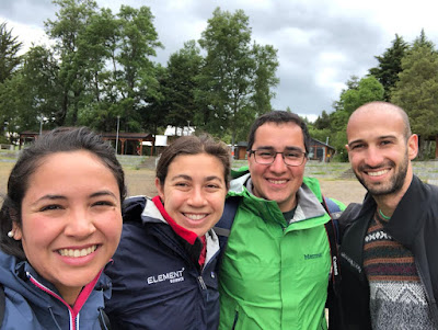
Our new friends
Lago Caburgua, Playa Blanca, and Playa Negra were also very pretty, but... after hearing people describe the Chilean south with stars in their eyes, we were a little disappointed.
There's a pleasant 30-minute hike between Playa Negra and Playa Blanca

Playa Negra looks like Playa Blanca at Lago Caburga
After grabbing an empanda, we parted ways with our friends and decided to hit up Huerquehue National Park next, which is about a 20-minute drive away. We went straight there, only to be informed that the last bus left in two hours, long enough to maybe hike to a waterfall (it was not long enough to reach the waterfall). The park ranger casually told us if we missed the last bus, we could catch a ride back to Pucón with someone else leaving Huerquehue.  He was extremely confident considering if he was wrong he'd be the one who had to deal with us.  When we made it back to Pucón we checked out the scenic Lago Villarrica coastline around sunset.  It honestly looked pretty similar to Lago Caburga, so we're not sure you need to see both, though one is definitely worth a stop!


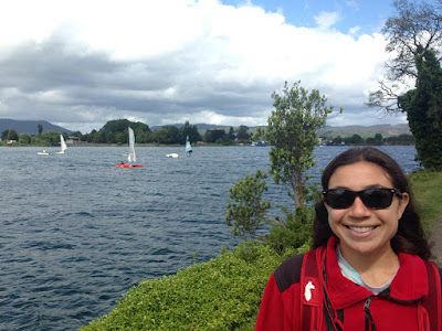
Lago Villarrica Beach in Pucón- Many of the mountains in this region were formed by glaciers.  We're not exactly sure why, but their rocky edges and green faces look tropical to us.

Most beaches in the area had these atlernative-looking water bikes (aka paddle boats) for rent.  We wanted to give them a shot, but ended up doing so much hiking we were too tired to work in more leg-intensive activities.


All in all, our first day felt a little like a dud. But now that we had the lay of the land, we came back to Huerquehue the next day and set off as soon as it opened. And it's a good thing we got such an early start because the only open trail took us 7 hours of continuous hiking (and we didn't even do the whole thing!). It passed two waterfalls, a few lookouts with impressive views of the nearby lake and volcano, and ended at a circuit of a few lakes.  It's the hardest hike Karen's done in years, so kudos to her!

Sites from a farm/hostal near the entrance to Huerquehue National Park.
These geese(?) were HUGE and protective of their babies


Sights from the Trail-  We passed 4 lakes, 2 waterfalls, and of course, saw lots of views of Volcán Villarrica.


These funky looking trees are called Araucarias and are hundreds to thousands of years old.  They grow *really* slowly and when they mature they produce a large pine nut called a piñon used in indigenous dishes.  The region of Chile surrounding Pucón is named after the Araucaria and it carries a lot of cultural and historical significance.  

An Araucaria branch


We'll leave you with our favorite view from the hike.  It's about an hour before we reached another lookout over other lakes.  If we were to do the trail again, we'd call it a day here.  Call us lake snobs, but after a while they start to look the same.

Tuesday, November 26, 2019

The City of Foz do Iguaçu

Foz do Iguaçu

  After 3 consecutive days of waterfalls, we decided to take a rest day.  We slept in a couple hours and then headed to the bus station to spend the afternoon in the city of Foz do Iguaçu- this is the Brazilian city closest to the falls.  The bus runs every hour and we were told it stops at the Argentinean border and waits for you while you go through border control.  What we were not told is that the bus will not wait for you at the Brazilian border... border control here takes about 2 minutes, but you have to wait another hour for the next bus :/

  Fortunately, our bus driver mentioned this when we got on and let us get off to ask for a refund.  We weren't really too jazzed about the idea of spending an extra hour each way waiting at the border for another bus.  After getting the ticket refunded, we "splurged" for a taxi across the border.  The 30-minute ride comes out to $15 USD and the taxi will wait for you at the border.  (The bus would have been $3 USD/person).  

  The night before, we texted our Brazilian friend (who now works in Chile) for tourist tips in Brazil.  She was so eager to help she googled a variety of restaurants and bars for us to visit.  She also listed out a bunch of foods to try... and thus our self-made food walking tour of Foz do Iguaçu was born.


An Açaí Slushie- Brazil is the home of the Açaí fruit and it makes for a refreshing treat in the afternoon heat!

  After a refreshing Açaí Slushie, we stopped into several stores asking for "Coxinha do frango com catupiry".  We weren't quite sure what this was, but our Brazilian friend assured us it was good.  Store clerks were very friendly and after popping into 4 stores and stumbling through some language barriers, we finally found some!  

  The bakery where we found the Coxinha had an interesting payment system.  Upon entering we each had to take a plastic tile and walk through a turnstile- much like a pay-parking garage.  Then, when we went to the bakery counter to order anything, they scanned our tile barcode.  When we were ready to leave, we went to a counter to pay with our tiles.  Finally, to exit, we had to insert the plastic tiles into another turnstile, which then let us exit.


Coxinha do frango com catupiry, Quibe frito, Coxinha do carne seca com catupiry.

  These may look like light snacks, but don't be fooled, they are DENSE.  The outer two are the "coxinha", which turns out to be a deep-fried manioc dough with a bundle of chicken or meat with cheese inside.  Karen thinks the seasoning made them taste a bit like chicken nuggets.  The dough had a glutenous texture and was very tasty.  The middle item is Quibe frito and it was divisive.  It's a deep-fried nugget of bulgar and meat with a minty seasoning.  Matt hated it... it had a bit of paté inside that he found unsavory.  Karen, on the other hand, thought it was okay, but preferred the coxinha. 


 Mbeyú

  Mbeyú is a manioc-based pancake filled with sliced ham and cheese.  We had it as an appetizer before dinner.  Overall a bit dry, but interesting crunchy texture.


Picanha, or Sirloin Cap

  The favorite cut of steak in Brazil is Picanha, or Sirloin Cap.  It's everywhere and it's got lots of flavor!  It's a thin cut, but they manage to keep it red in the middle and it packs a lot of good, gamey flavor.

We also hit up a supermarket and saw these items:

Atemoia- a hybrid of the chirimoya and sugar apple.  They weren't ripe, so we didn't get to try them, but the texture is neat.


Goiaba- this wasn't ripe either, but our Brazilian friend likes them a lot!  They're frequently used to make a preserve and eaten with cheese.


This handle of Brazilian hard liquor only comes with a bottle cap!?  I guess if you're drinking it you're supposed to go hard.


Karen bought these thinking they were chicharron.  Chileans don't really eat this chip-style of chicharron, so she was excited to have the chance to indulge!  Unfortunately, we were disappointed when we opened the package- they are particularly chewy and hard.  It turns out you're meant to cook them 


Grape-Avocado Ice Cream

  If you haven't suspected by now, we didn't have the chance to eat *all* of these items on our afternoon excursion to Brazil.  We did try a few on the Argentinean side of the falls since there's some cross-over.  We'll have to come back to try the rest :)

Monday, November 25, 2019

Return to Iguazu


  Since two full days of waterfalls were not enough, we headed back to the Argentinean side of the park on Friday.  To get to the park, we were planning on taking the bus.  However, a taxi driver pulled up and asked if 4 of us wanted to go to the park for the same rate/person as the bus.  Another We took him up on it with another Argentinean couple.  We ended up getting to the park about 30 minutes early, and found ourselves in the same situations as the day before when we were on the Brazilian side of the park... on the first Train in!!!

  We took the train to Karen's favorite spot in the park: Devil's Throat.  It's also located the furthest from the entrance, so it takes a good hour or so for people who go on foot to arrive.  Our train included LOTS of large organized tour groups with guides.  I guess this is the professional strategy to enjoying the park. 

  Many people don't recommend going to Devil's Throat in the early am since the sun is rising overhead and adds a lot of glare to the view.  We had already been in the afternoon and were more interested in seeing the falls with less people around.  (It does feel a bit like Disneyland or a concert when you walk around in the afternoon... and we're not even here during peak season!)  Looking at the falls without sunglasses for more than a minute was definitely a strain on the eyes, but with sunglasses on it was no problem.  Despite the glare, the falls were *beautiful*.


Devil's Throat by Morning

On the train ride back to the other trail heads in the park, we saw a pack of about 7 Coatíes aggressively searching/begging for food among the tourists.  They are pretty cute.


Coatíes can climb trees :0

  Next up, we headed to the only trail in the park that does not include a view of the waterfalls.  Why!?  For good wildlife viewing!  The Macuco Trail is a 3.5km walk through a less developed section of the park.  On a good day, you're supposed to be able to catch a glimpse of monkeys.  On the way out, we walked *really slowly* and really quietly to see what we could.  Unfortunately, we didn't see monkeys, but we did see dozens of neat birds, insects, including GIANT ants and a grasshopper-ish critter that looked like a leaf, and even some small mammals, including a mouse-sized possum and carpincho.  

Note we didn't take any of these animal photos (we were too busy looking)... they're all from the internet.

The Acari Toucan


A Carpincho- these were particularly loud when walking through the forest.  We picked the photo with the foot to show its size.  Too big to be a guinea pig and too small to be a capybara.  It was a bit sad that when a helicopter tour passed overhead, the sound really freaked out the one we were watching.  The helicopter tours pass every half hour :/


We also saw this small (mouse-sized) species of opossum. They have semi-prehensile tails and the one we saw was gathering a bunch of small sticks and holding them in its tail.

  Overall, we spent a good two hours making our way through the trail one way.  The trail ends with a little waterfall and a watering hole, where many people swim even though it is prohibited.  Right around then thunder, lightening, and rain started to come down pretty strong.  Many people did not get out of the watering hole!?  We made a beeline back along the trail to seek cover out of the forest.  It took us a solid hour and we got soaked.  Since it's so hot out, the rain was actually refreshing.  Unfortunately, no time for nature-watching on this leg.

  Given the success of yesterday's buffet, and our exhaustion, we did the easiest thing for lunch which was the buffet on the Argentinean side of the park.  It featured a tasty parrillada of assorted meats and a bar of other dishes.  Definitely not as good as the Brazilian buffet, but it hit the spot.

  We wrapped up the day with the Lower Circuit loop, which gives you a good panorama view of the falls.  It was fun to watch the boats approach the falls from this vantage point.

The boat in front of San Martin island, between the two main sides of the falls.


Approaching the falls.


In the falls!  (Squint into the mist.)

  We definitely enjoyed the Lower Circuit- it gave us a good look at lots of the smaller waterfalls which are densely packed along the Argentinean side of the park.  We hadn't appreciated how many there were before this, since many are hidden from the other trails in the park.

  Overall, today was our longest walking day!  Approx. 14km or 9 miles in total.  Whew!  Back in town we treated ourselves to Dulce de Leche ice cream, and perused an upscale wine store before passing out.